**Update: This post is slightly out of date. The latest FKTs I am aware of will be stored on my FKT Page accessible in the menu above.***
Chasing speed records is addicting. With the advent of Strava and the exploits of Killian Jornet and others, it is difficult not to get caught up in the hype of seeking out a fastest known time (FKT). The whole purpose appeals to athletes differently than a traditional race format. Sure, you are competing against a clock but usually that is where the similarities end. Chasing an FKT allows the athlete to pick the mode, route, and timing of their choosing. You can lie in wait and train until you’re ready to tackle the goal. You can define your own style: supported/unsupported, solo/with a partner, and so on. GPS enabled watches have encouraged chasing speed records because they allow easy confirmation and comparison.
Every town or region in the world has it’s test piece. It could be a small hill or a big mountain. It isn’t always the most prestigious trail in the region but regardless of the distance or vertical gain, it is something you can out down a hard effort on. Luckily, we live in an amazing location with an abundance of steep trails, big mountains, and endless alpine and valley terrain.
In the interest of inspiring a bit of friendly competition, here are my choices for the top FKTs of the Sea-to-Sky region. By top, I mean routes that follow a logical line, cover high quality terrain, and are accessible/popular enough that more than just a select few have attempted them as a hard effort. I have also given my suggestion for timing yourself via each specific route – use it, or do whatever you want! The routes that I have already attempted also have a link to a GPS track.
Howe Sound Crest Trail – Gary Robbins – 3:45
Distance: 29k
Vertical Ascent/Descent: 1830/2600m
At the far South end of our region, the HSCT starts at Cypress Mtn. in N. Vancovuer and traverses along the Crest past The Lions to Deeks Lake. This is frequently hiked partially or over several days and less frequently run. Incredibly scenic with views of glacial peaks and Howe Sound.
Timing: Time yourself from the edge of the Cypress Mountain parking lot to your car on Hwy. 99 (point to point).
Route: Buy the North Vancouver/HSCT trail map from just about any outdoor gear shop in Vancouver. A car shuttle is required to return to Cypress (unless you run back – double HSCT FKT?).
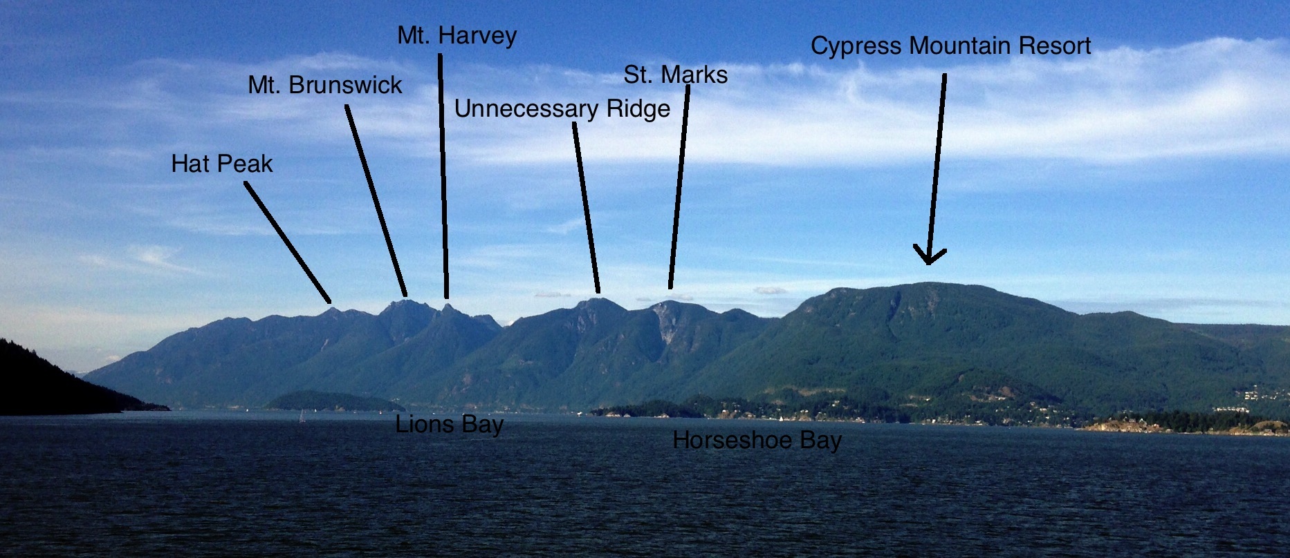
The Howe Sound Crest and it’s peaks.
Sky Pilot – 1:53.50 Eric Carter
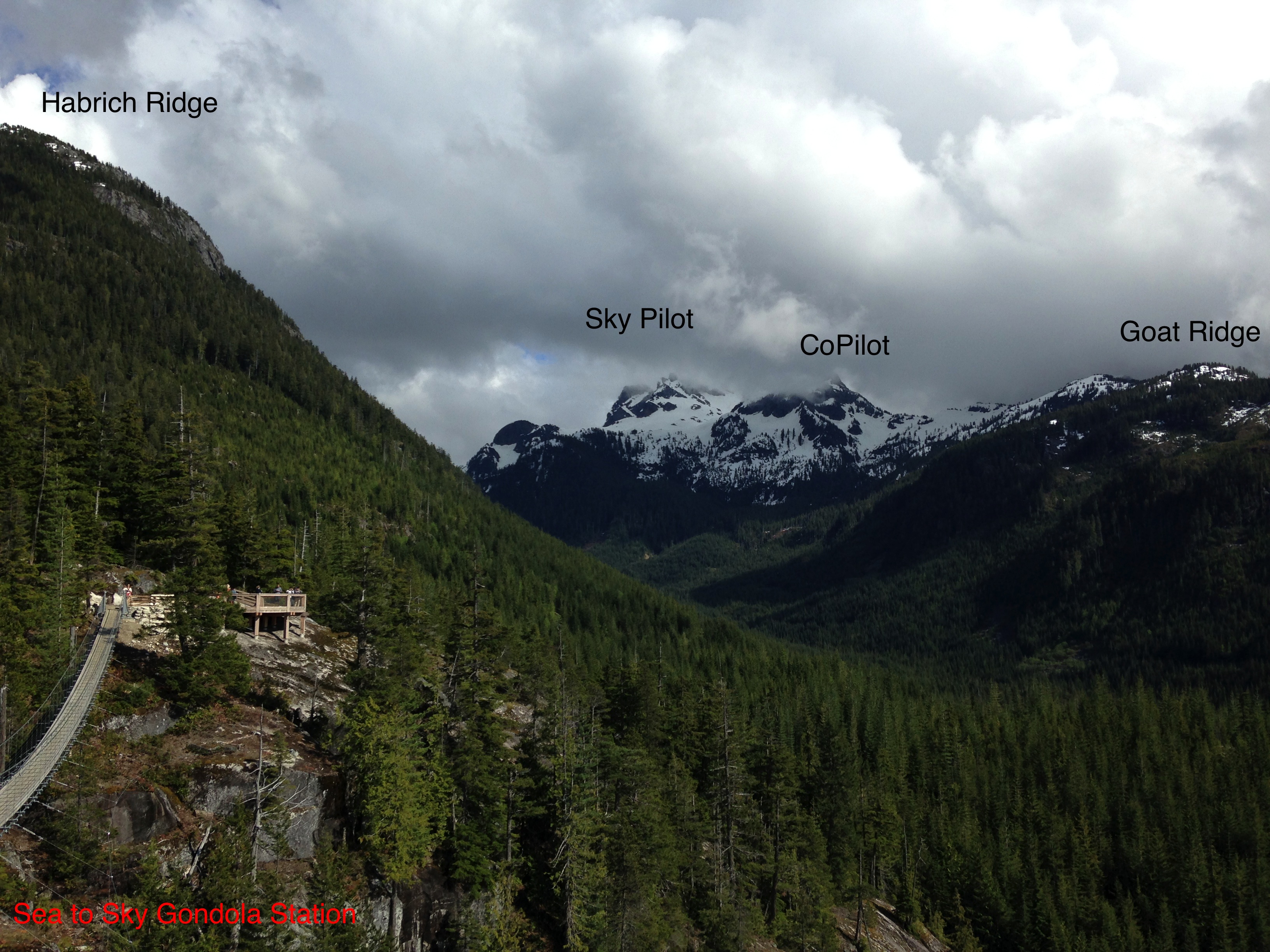
The upper Shannon Creek Valley from the Sea to Sky Gondola.
Distance: 15.5km
Vertical Ascent/Descent: 1300m
Prior to the construction of the S2S Gondola, Sky Pilot was relatively difficult to get to with a very poor trail. Access has significantly improved to give this significantly more attention and traffic. The trail starts with an old road bed, climbs scree and rock to a glacier and then follows a technical scramble route to the summit.
Timing: Start/stop watch at the big map signpost at the gondola top station (round trip).
Route: Follow the newly brushed out road marked on the gondola trail maps as Sky Pilot Valley Trail to the end of the old road. From here follow flagging and the route described in Scrambles in SW British Columbia by Matt Gunn. The trail is currently rough and does not allow for the fastest travel. The scrambling portion is long with significant exposure. A few parties utilize a rope and belays.
Sea to Summit Trail – ?
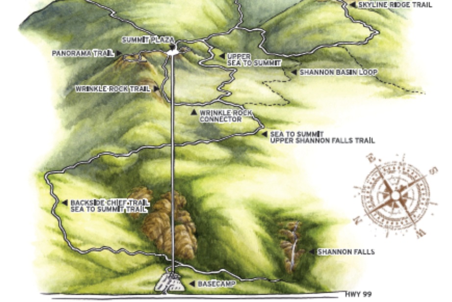
Sea to Summit Trail Map (from Gondola website)
Distance: 7km
Vertical Ascent/Descent: 700m
Newly opened up with the S2S Gondola and included because of the sheer numbers that attempt the trail leading from the bottom station to top station. In a similar vein to Vancouver’s Grouse Grind, the trail follows a more circuitous route to the top but with more elevation gain.
Timing: Start your watch at the trail signpost before you enter the trees and stop it at the big map signpost when you arrive at the gondola top station (point to point).
Route: Follow the well marked Sea to Summit trail from the base of the gondola. See gondola trail map.
1st Peak of the Chief (Signpost to Summit) – 17:53 Nick Elson
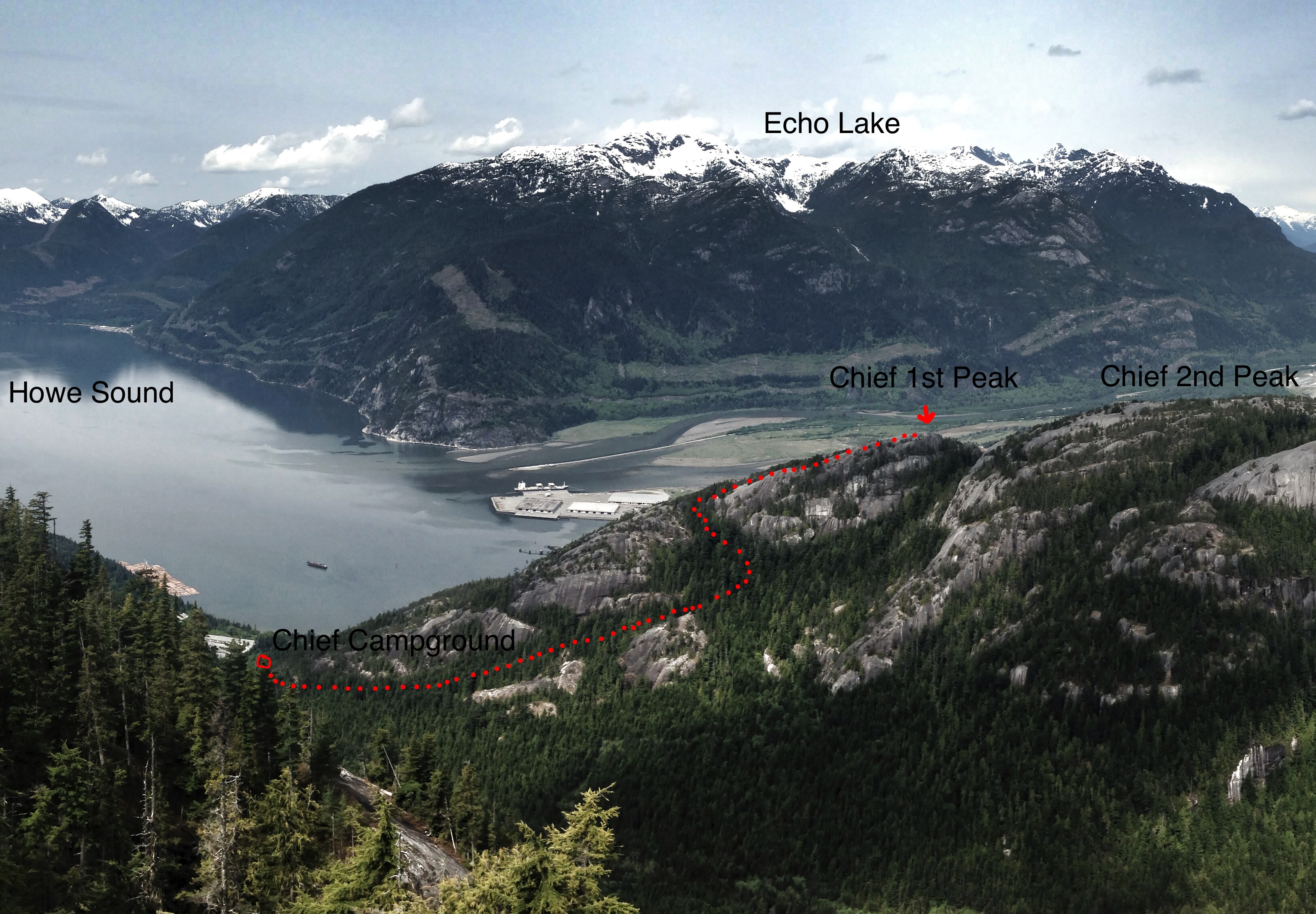
Squamish Chief backside trail.
Distance: 1.5km
Vertical Ascent/Descent: 570m
The gem of Squamish and likely the most classic of the list. The Chief is an inspiring granite dome with a trail up the backside. Warm up in the campground and jog to the base of the stairs. The Chief has traditionally been timed trailhead to summit. Likely because descending the trail fast could spell disaster in the event of a collision among the hoards of ascending tourists. Though that does not seem to stop a few from bombing back down as there is also a fairly competitive Strava segment for the 1st peak descent!
Timing: Start your watch at the signpost at the base of the stairs and stop it at the top of the 1st Peak (point to point).
Route: Follow the well marked 1st peak trail up the backside of The Chief.
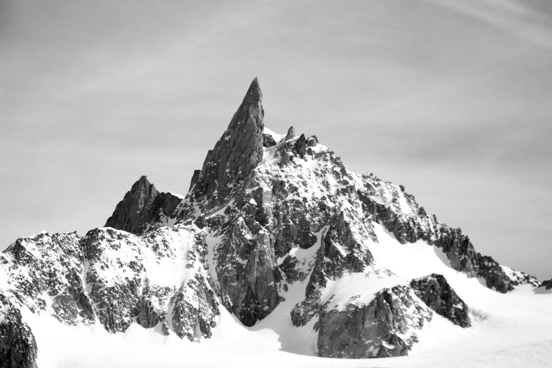
Black Tusk – 2:37 Eric Carter
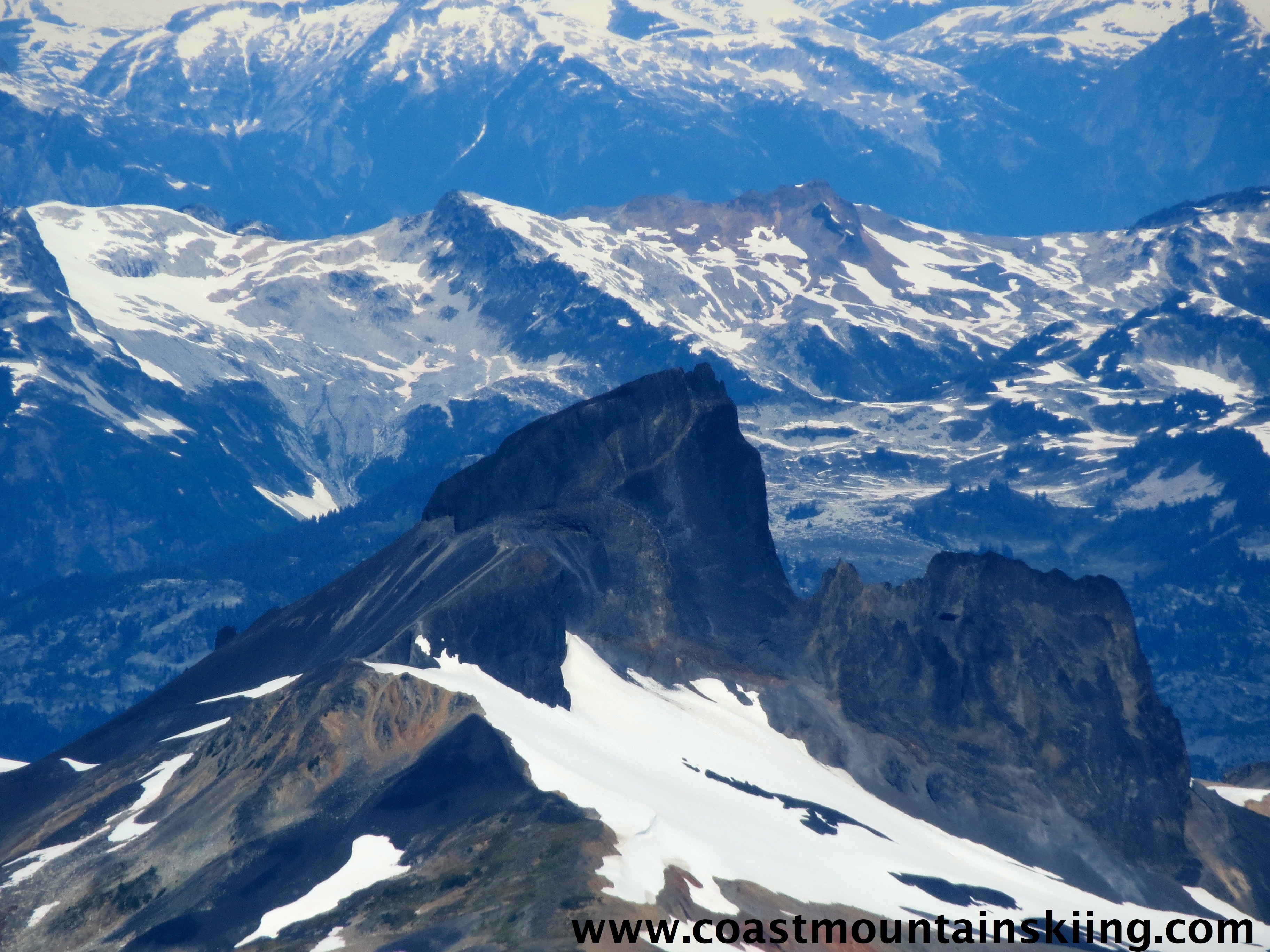
Black Tusk viewed from above.
Distance: 23km
Vertical Ascent/Descent: 1770m
Black Tusk is an old volcanic plug seen from Hwy. 99 when driving between Squamish and Whistler. A super popular tourist trail, the route to Taylor Meadows is well packed gravel that allows easy running. The turnoff for the Tusk puts you onto volcanic scree before tackling the final scramble up the summit chimney. Top out on the sub-summit (true summit requires ropes and serious skill/bravery) and then descend back to the trailhead.
Timing: Start your watch at the trailhead of the Garibaldi Lake Trail and stop it on return.
Route: Follow the route described in Matt Gunn’s Scrambles in SW BC. The trail is much more runnable than Sky Pilot and the scrambling much shorter lived with little exposure.
These are certainly not the only trails worthy of FKT attempts. I challenge the mountain runners of SWBC to head out to the trails and try your hand at a fast time on one of these trails or find your own route that inspires you. Think you ran faster than the time I listed? Post in the comments and I will add it in! Click on the FKT page tab at the top to see more running an skiing times. I will try to keep that page up to date.
car to car black tusk in 3.45, sub summited in 2.15
Nice!